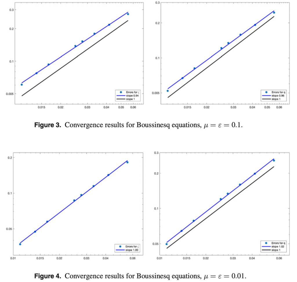
(Bordeaux, salle 2 de l’IMB)
- 14h00-15h00 Nicolas Barral (Imperial College London) : Framework pour des simulations côtières avec adaptation de maillage anisotrope
- 15h00-16h00 Kevin Martins (EPOC): Wave transformation in the surf zone: new insights from 2D LiDAR scanners
Nicolas Barral: Framework pour des simulations côtières avec adaptation de maillage anisotrope. La plupart des simulations numériques pour l’ingénierie marine requièrent la modélisation de larges zones géographiques, alors que la quantité d’intérêt est très localisée (par exemple les systèmes de génération d’énergie marémotrice, ou l’étude de l’impact de tsunamis sur des zones habitées ou à risque). La taille des domaines considérés, combinée à la haute précision requise conduisent généralement à des simulations très coûteuses en temps de calcul.
L’adaptation de maillage a démontré depuis une vingtaine d’années son efficacité pour améliorer la précision numérique tout en réduisant le temps de calcul en permettant un contrôle fin de la répartition des degrés de liberté. En particulier, l’adaptation de maillage anisotrope tire parti de la flexibilité des maillages non structurés, et permet d’optimiser à la fois la taille et l’orientation des éléments du maillage. La génération de ces maillages adaptés est basée sur des champs de métriques Riemanniennes, eux-même dérivés d’un estimateur d’erreur, a priori ou a posteriori. La construction de cet estimateur d’erreur, propre au modèle étudié, est essentiel au processus d’adaptation. Dans cette présentation, on considère des métriques « multi-échelles » basée sur la Hessienne des champs de solution, qui sont capables de capturer les différentes échelles des dynamiques océaniques et des structures d’ingénierie étudiées.
L’efficacité de ces estimateurs d’erreur peut être considérablement améliorée en considérant des approches dites « goal oriented », qui sont en cours de développement dans notre framework: en considérant l’adjoint de la solution dans le modèle d’erreur, seuls les phénomènes physiques ayant une influence sur une certaine quantité cible sont maillées et résolues avec précision.
Dans cet exposé, je présenterai l’implémentation d’un framework permettant de réaliser de telles simulations adaptatives dans notre code de simulations côtières Thetis, s’appuyant sur son intégration sous-jacente avec PETSc. On considéra des applications pour la modélisation de la propagation de tsunamis, ainsi que la modélisation de structures de générations d’énergie marémotrice (barrages ou turbines).
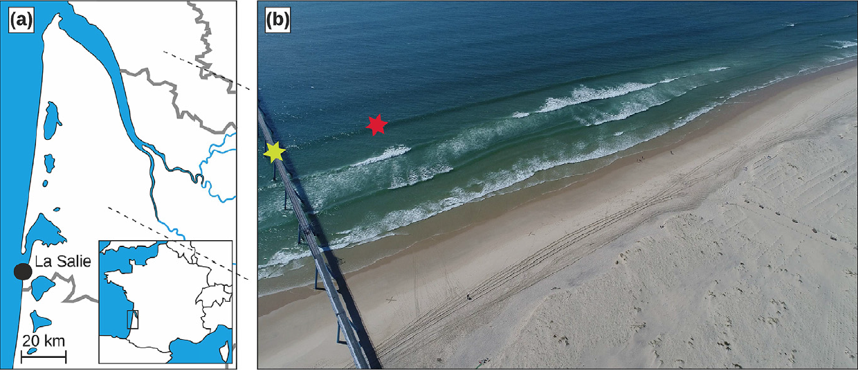
Kevin Martins: Wave transformation in the surf zone: new insights from 2D LiDAR scanners: Over the last few decades, remote-sensing technology became an essential tool for improving our understanding of nearshore processes. Very recently, the application of lidar scanners (Light Detection And Ranging) to study swash zone hydrodynamics and morphodynamics was made possible thanks to the initiatives of few researchers. In this talk, I will present my PhD work, in which we explore the use of 2D lidar scanners to monitor the time-varying surface elevation of breaking waves in the surf zone. The surf zone constitutes one of the most challenging environments where to deploy instruments, due to the energetic wave conditions often found there. Hence, obtaining direct measurements of wave profiles at a high sampling rate represents a unique opportunity to better understand wave transformation in the surf zone.
In the first part, I will describe the working principles of 2D lidar scanners, and its potential applications to study nearshore hydro- and morphodynamics. In a second part, we use an innovative laboratory dataset to validate a CFD model of breaking wave in a wave flume at prototype scale (BARDEXII experiments). This numerical model is used to study and quantify the influence of wave reflection, generated at the inner surf/swash zone boundary, on surf zone hydrodynamics at various temporal scales. Then, the main field experiments performed during my PhD is presented. An array of three lidar scanners was deployed from a nearshore pier at Saltburn-by-the-Sea (UK) to monitor waves from the shoaling area and up to the runup limit. New insights on individual wave properties at breaking and on energy dissipation rates in the inner surf zone were obtained and will be presented. I will conclude by briefly describing my current work and how lidar data can be used to improve the parameterizations of physical processes in the surf zone.